Why Kekova's History Matters
Most visitors experience Kekova as a half-day boat trip — a pleasant cruise past some submerged walls, a quick climb to a castle, and a swim in a turquoise bay. But beneath the surface, literally and figuratively, lies one of the most remarkable archaeological stories in the Mediterranean: three ancient cities that operated in parallel for centuries, a catastrophic geological event that drowned one of them, and a modern conservation battle that turned this stretch of coast into Turkey's first marine protection zone.
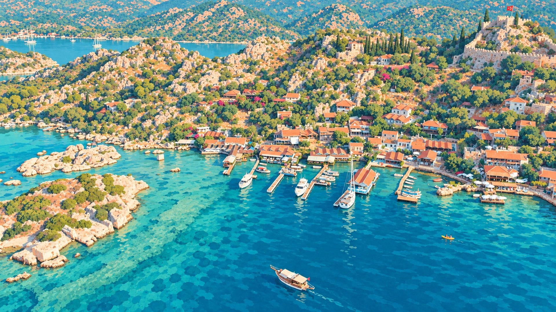
What makes Kekova's history unusual is not a single famous figure or a single defining monument — it's the interplay between three settlements that occupied the same bay but served entirely different functions. Dolichiste clung to the sheltered southern shore of Kekova Island, its houses and harbour built into a narrow strip between rock and sea. Simena perched on the hilltop directly opposite, watching over the strait from a defensive position that would later prove invaluable. And Teimiussa, at the head of the bay, operated as the commercial gateway — the point where inland trade routes met the sea.
Understanding this three-city dynamic transforms a Kekova visit from scenic to meaningful. The submerged ruins you glide over aren't generic "old walls" — they're the residential and commercial districts of a specific Lycian port town, Dolichiste, whose citizens lived and traded alongside their neighbours at Simena and Üçağız for the better part of a millennium.
Lycian Origins: Three Cities, One Bay (5th–3rd Century BCE)
By the 5th century BCE, three independent settlements had established themselves around the natural harbour formed by Kekova Island and the mainland coast. Each occupied a distinct geographical niche, and each developed a distinct civic identity — though all three were Lycian in language, culture, and political affiliation.
Dolichiste: The Island City
Dolichiste occupied the southern coast of what is now Kekova Island (“Kekova Adası” in Turkish). Its position was strategically excellent: sheltered from northerly winds by the island's ridge, with a natural harbour facing the mainland. Archaeological evidence — including harbour walls, residential foundations, stairways cut into the rock, and water cisterns — indicates a well-developed urban settlement with a functioning port infrastructure.
The name “Dolichiste” appears in limited ancient sources. The settlement is attested primarily through inscriptions and coin evidence rather than literary references — a reminder that not every significant ancient city attracted the attention of Greek and Roman historians. What we know about its physical form comes largely from what the sea preserved after the earthquake: the southern strip of the city, now submerged under 1 to 3 metres of water, is one of the best-preserved underwater archaeological sites in the eastern Mediterranean.
Simena (Isimea): The Fortress Hill
Directly opposite Dolichiste, on the mainland, Simena clung to a steep, rocky hill overlooking the strait. The ancient name “Isimea” is attested in Lycian inscriptions; the Greek form “Simena” appears in later sources. The settlement's defining feature was its elevation and defensibility — a characteristic that would make it the last of the three cities to remain continuously inhabited, right through the Byzantine and Ottoman periods to the present day, as the village of Kaleköy.
Among Simena's most remarkable survivals is a tiny rock-cut theatre carved into the hilltop, believed to be the smallest ancient theatre in Anatolia, with seating for roughly 300 spectators. Lycian rock-cut tombs and sarcophagi are scattered across the hillside and along the waterfront — some of them standing in shallow water, half-submerged by the same tectonic activity that sank Dolichiste.
Teimiussa: The Trading Gateway
At the eastern head of the bay, Teimiussa occupied the site of today's Üçağız village. It served as the bay's primary commercial harbour — the point where land-based trade routes from the Lycian interior met the maritime network of the Mediterranean coast. Rock-cut tombs along its eastern shore, Lycian sarcophagi dotted through what is now the village centre, and the remains of a small fortification confirm its antiquity and civic status.
Teimiussa's Lycian-era sarcophagi are among the most accessible ancient monuments in the region. Several stand in the shallow water at the harbour's edge, some have been incorporated into restaurant terraces and garden walls, and at least one prominent rock tomb sits directly beside the modern village road. It's an oddly intimate form of archaeological preservation — the ancient dead and the living sharing the same streetscape.
Growing up in Demre, Kekova was our weekend escape — the place you'd go on your uncle's fishing boat. As a kid, I remember looking down through the water and seeing straight lines that clearly weren't natural rock. My grandfather would say, “there used to be a city here, and the sea took it.” It wasn't until much later that I understood those lines were the walls and stairways of Dolichiste — the remains of actual houses where people had lived 2,000 years ago. That childhood memory is why I think the history matters: without it, you just see blurry shapes in blue water. With it, you see a drowned city.
The Lycian League Connection
All three Kekova Bay settlements were part of the Lycian League, the democratic federation of approximately 23 cities that the Greek geographer Strabo described in such detail that it later influenced the architects of the American Constitution. While none of the three held the maximum three votes reserved for the six largest cities (Xanthos, Patara, Myra, Pinara, Tlos, and Olympos), they participated in the League's federal assembly and contributed to its collective defence and trade networks.
The bay's strategic value to the League was primarily maritime. Kekova's sheltered waters offered safe anchorage for the Lycian fleet, and the narrow channel between the island and the mainland created a naturally defensible passage. Teimiussa, as the commercial harbour, would have served as a redistribution point for goods moving between the coastal shipping lanes and the mountainous Lycian interior. The timber resources of the surrounding hills — prized by both the Ptolemies and the Romans for shipbuilding — added economic importance to the bay's strategic geography.
Hellenistic Crossroads (4th–1st Century BCE)
Alexander the Great's conquest of Anatolia in the 330s BCE brought Lycia into the Greek-speaking world, though the practical effect on small coastal settlements like Kekova's three cities was less dramatic than the political headlines might suggest. The bay's daily rhythms — fishing, timber, coastal trade — continued largely undisturbed. What changed was the larger geopolitical framework: after Alexander's death in 323 BCE, his empire fractured into successor kingdoms, and the Lycian coast became a contested frontier between the Ptolemies of Egypt and the Seleucids of Syria.
For Kekova Bay, Ptolemaic influence was the more significant of the two. Egypt's Ptolemaic dynasty, which controlled much of the southern Anatolian coast for extended periods during the 3rd century BCE, valued the region's timber for shipbuilding and its sheltered harbours for naval operations. Teimiussa's role as a commercial gateway almost certainly expanded during this period, as the bay's position between the open Mediterranean and the Lycian interior made it a natural waypoint for Ptolemaic naval and trade routes. Archaeological evidence from this era is sparse at Kekova compared to larger Lycian cities like Patara or Xanthos, but Hellenistic pottery fragments and building techniques identifiable at Simena and Teimiussa confirm the settlements' continued occupation and modest prosperity.
The decisive political shift came in 168 BCE, when Rome defeated the Macedonian kingdom and, in a rare act of diplomatic generosity, recognised the Lycian League's independence rather than absorbing it directly. For the next century, the League operated as a Roman ally with genuine self-governance — a period often described as the League's political golden age. The Kekova Bay cities participated in this flourishing, their commercial networks expanding as the wider Mediterranean became safer under Rome's growing naval dominance.
Roman Prosperity (1st–2nd Century CE)
When Rome annexed Lycia as a province in 43 CE under Emperor Claudius, the three Kekova settlements continued to function much as before — the political independence of the Lycian League was lost, but its commercial and cultural institutions endured. For the Kekova Bay cities, the Roman period brought increased trade, infrastructure investment, and integration into the empire's vast Mediterranean supply network.
Dolichiste's harbour was expanded and improved with stone quays and warehousing. Simena's fortifications were maintained and possibly enhanced. Teimiussa's role as a trading hub connected the bay to the grain routes that ran between Egypt and Rome — the same routes that passed through Myra's harbour at Andriake, just 35 kilometres to the west.
The archaeological evidence from this period includes Roman-style bath foundations on Kekova Island, cistern systems with characteristically Roman hydraulic concrete, and pottery assemblages that indicate trade connections spanning Egypt, the Aegean, and the Italian peninsula. Coins minted during the Roman imperial period have been found in the waters around the sunken city, providing dating evidence for the structures now submerged.
The Kekova Earthquake That Sank a City (2nd Century CE)
Sometime during the 2nd century CE, a seismic event — or possibly a series of events — caused the southern coastline of Kekova Island to subside by between 1 and 3 metres. The effect was catastrophic for Dolichiste. The harbour, the waterfront buildings, the stairways leading down to the sea, the cisterns, and the lower residential quarters slid beneath the surface. What had been a functioning port town became an underwater ruin.
The precise dating and mechanism of this subsidence remain subjects of scholarly debate. Some geologists argue for a single large earthquake, possibly the same regional seismic event that affected other parts of the Lycian coast in the mid-2nd century CE. Others propose a more gradual process of tectonic subsidence, with the island's southern edge slowly tilting over decades or centuries. The evidence — including the relatively consistent depth of submersion along the coastline and the preservation of intact stairways and wall courses — seems to favour a relatively rapid event rather than a slow creep, but absolute certainty has proven elusive.
The sea didn't destroy Dolichiste — it preserved it. The structures that would have crumbled to nothing on dry land over two millennia were instead sealed beneath salt water, protected from the weathering, looting, and repurposing that erased most ancient cities.
DenizWhat makes Kekova's sunken city so archaeologically valuable is precisely this paradox of destruction-as-preservation. On land, ancient buildings are quarried for stone, overbuilt by later civilisations, eroded by rain and frost, and disrupted by agriculture. Underwater, the walls remain in place. Stairways still lead from what were once front doors down to what was once a quayside. Cisterns still hold their shape. The outline of an entire urban district is legible from a boat — or, even more vividly, from a sea kayak gliding a metre above the ruins.
Simena and Teimiussa survived the earthquake. Their mainland positions were less affected by the coastal subsidence, though evidence of seismic damage exists at both sites. Simena's waterfront Lycian sarcophagi, some of which now stand partially submerged, suggest that the mainland coast also dropped by a smaller amount — perhaps half a metre — during the same event.
For a detailed guide to what you can see at the sunken city today — specific ruins, viewing points, photography tips, and protection rules — see our dedicated Sunken City Guide →
Byzantine Fortification (7th–11th Century CE)
The Byzantine period transformed Simena from a modest hilltop settlement into a fortified military outpost. Beginning in the 7th century, Arab naval forces launched devastating raids along the entire Lycian coast — the same campaigns that damaged Myra and its harbour at Andriake. Simena's elevated position and its command of the narrow channel between the island and the mainland made it a natural defensive point.
The castle that crowns Kaleköy today dates primarily to this Byzantine defensive programme. Built from local limestone using characteristically Byzantine masonry techniques — thick walls with rubble cores, defensive towers at irregular intervals, and a cistern system to sustain a garrison during siege — it was designed to protect the remaining population of the bay from seaborne attack. Small Byzantine churches were also constructed within and around the settlement, and a monastic community may have existed on the island during this period.
Dolichiste, by now submerged for centuries, played no role in the Byzantine defence of the bay. But the island itself remained strategically relevant — its ridge blocked direct approach from the open sea, and the shallow waters over the sunken city made it difficult for large warships to navigate the southern channel. In a grim irony, the earthquake that destroyed the city may have improved the bay's defensibility.
Knights of Rhodes (14th–15th Century)
In the 14th century, the Knights of St. John — better known as the Knights of Rhodes — established a presence along the southern Anatolian coast, using a network of castles and watchtowers to protect their maritime interests and Christian pilgrimage routes. Simena Castle was one of several fortifications they garrisoned or expanded in the region.
The Knights' modifications to Simena Castle are visible in the masonry record: they added bastions, improved the curtain walls, and constructed a more substantial gatehouse. Their building technique — larger, more regularly cut ashlar blocks compared to the smaller, rougher Byzantine masonry — is clearly distinguishable in the castle's fabric. The coats of arms and decorative elements sometimes associated with Crusader-period castles have not been definitively identified at Simena, suggesting it was a functional outpost rather than a major commandery.
The Knights' presence in the region ended in the late 15th century as Ottoman naval power expanded across the eastern Mediterranean. By the time Sultan Mehmed II's successors consolidated control over the Lycian coast, the Knights had retreated to Rhodes and eventually to Malta.
Ottoman Centuries: Quiet Waters (15th–19th Century)
Under Ottoman rule, the Kekova Bay settlements faded from strategic significance into the rhythms of a quiet Mediterranean fishing economy. Kaleköy (Simena) and Üçağız (Teimiussa) survived as small villages — their populations numbered in the dozens rather than hundreds — sustained by fishing, small-scale agriculture on the terraced hillsides, and the seasonal production of charcoal from the surrounding forests. Ottoman tax registers (tahrir defterleri) from the region record these settlements as dependencies of the kaza of Kaş, listing modest revenues from olive oil, goat herds, and coastal fishing rights — a portrait of villages too small to merit their own administrative status but too stubbornly inhabited to disappear from the records entirely.
Simena Castle fell into disuse, its walls slowly crumbling, though the village that had grown around its lower slopes continued to function. The ancient Lycian sarcophagi and rock tombs were absorbed into the landscape of daily life — used as storage, animal shelters, or simply ignored as unremarkable features of the terrain. Kekova Island, with its sunken ruins visible in the shallows, remained known to local fishermen but attracted no scholarly or tourist attention. Villagers built stone-and-timber houses using techniques virtually unchanged since the Byzantine period, and their wooden caiques — the small, broad-beamed boats still seen in Üçağız harbour today — were the primary link to the outside world, carrying goods to the weekly market at Kaş.
This four centuries of anonymity may have been Kekova's greatest protection. Unlike coastal sites that were quarried for building stone, industrialised, or overbuilt with modern infrastructure, the Kekova Bay settlements were too small, too remote, and too poor to attract the kind of development that destroys archaeological evidence. When European explorers finally arrived in the 19th century, they found the ancient fabric remarkably intact.
When I think about the Ottoman period at Kekova, I think about my grandmother's stories from Üçağız. Her family had been there “always” — meaning as far back as anyone could remember. They knew the underwater walls, they knew which sarcophagus lid made a good bench, and they knew the castle was old. What they didn't know, because nobody had told them, was that the ruins had names and dates and a place in textbooks. That disconnection between local knowledge and academic knowledge is something this guide tries to bridge.
European Rediscovery (19th Century)
The first systematic European documentation of the Kekova Bay ruins came from Captain Francis Beaufort of the Royal Navy, who surveyed the Lycian coast in 1811–1812. Beaufort — the same officer who devised the Beaufort wind scale still used in meteorology — noted the submerged structures along Kekova Island's southern shore and recorded Simena's castle, theatre, and sarcophagi in his published account, Karamania (1817).
Beaufort was followed by Thomas Abel Brimage Spratt and Edward Forbes, whose Travels in Lycia (1847) provided more detailed archaeological descriptions. Spratt, a naval officer and geologist, was among the first to connect the submersion of Dolichiste to seismic activity rather than rising sea levels — a distinction that anticipated modern geological understanding by over a century.
Throughout the later 19th and early 20th centuries, a succession of European and Turkish scholars surveyed, mapped, and photographed the bay's ruins. But unlike Myra, with its spectacular rock tombs and theatre, Kekova never became a major archaeological excavation site. The underwater ruins were difficult to study with the technology of the era, and the mainland sites were small enough to document without large-scale digging. This scholarly restraint, combined with the region's remoteness, meant that Kekova entered the modern era with its archaeological fabric largely undisturbed.
Modern Protection and Discovery (1990–Present)
The 1990 Specially Protected Area
The defining moment in Kekova's modern history came in 1990, when the Turkish government designated the entire bay as a Specially Protected Area (SPA) — one of the country's first marine protection zones. The decision was driven by growing concern over the impact of unregulated boat tourism on the underwater ruins: anchor damage, pollution from boat engines, physical contact from swimmers and divers, and the removal of artefacts by visitors had all been documented.
The SPA designation imposed strict rules that remain in force today: no swimming or diving in the sunken city protection zone, speed limits for boats passing the ruins, restrictions on anchoring, and a ban on drone flights over the area. These rules are enforced by the Coast Guard and have been credited with preserving the site's integrity — the underwater walls and stairways visible today are in significantly better condition than comparable sites elsewhere in the Mediterranean where no such protections exist.
I remember the transition. When I was very young, people would jump off boats and swim right over the sunken walls — you could reach down and touch the ancient stonework. Some people took pieces home as souvenirs. The protection rules changed all of that, and at first the local boat operators resented the restrictions. Now, three decades later, most of them understand that without the ban, there wouldn't be much left to show tourists. The rules saved the site — and by extension, saved their livelihood.
Üçağız: UNWTO Best Tourism Village (2025)
In 2025, the United Nations World Tourism Organization (UNWTO) selected Üçağız (Kaleüçağız) as one of the world's Best Tourism Villages — a recognition of the village's success in maintaining its traditional character and ancient heritage while serving as a functional tourism hub. The award highlighted Üçağız's unaltered stone architecture, the integration of Teimiussa's ruins into everyday village life, and the sustainable tourism model represented by the boat tours that depart from its harbour.
The UNWTO designation has raised questions about the future. Increased international visibility brings the risk of overdevelopment — the very phenomenon that the award was meant to celebrate Üçağız for avoiding. Local and national authorities face the challenge of managing growing visitor numbers while preserving the qualities that earned the recognition in the first place.
Ongoing Archaeological Research
Underwater archaeological surveys of the Kekova sunken city have been conducted at intervals since the 1970s, with the most recent campaigns using photogrammetric mapping and 3D modelling to create detailed digital records of the submerged structures. These surveys have confirmed the presence of at least two distinct building phases in the submerged district — an earlier Lycian/Hellenistic phase and a later Roman expansion — and have identified structures including harbour warehouses, a possible public bath, residential complexes with multiple rooms, and an extensive cistern system.
On land, archaeological work at Simena and Teimiussa has focused on documentation and conservation rather than large-scale excavation. The Lycian theatre at Simena has been cleaned and partially restored. Sarcophagi at both sites have been catalogued and, where possible, protected from further deterioration. But much remains to be studied — the full extent of Dolichiste's submerged district, the relationship between the three settlements' defensive systems, and the precise chronology of the tectonic subsidence all await further investigation.
Archaeological research at Kekova is ongoing. The information in this article reflects the state of knowledge as of early 2026. For the latest discoveries, check the Antalya Museum or the Lycian Civilizations Museum at Andriake, which houses many artefacts from the region.
Complete Chronological Timeline
The following timeline traces the major events in the history of the Kekova Bay region — from the earliest Lycian settlements to the modern era of protection and tourism.
